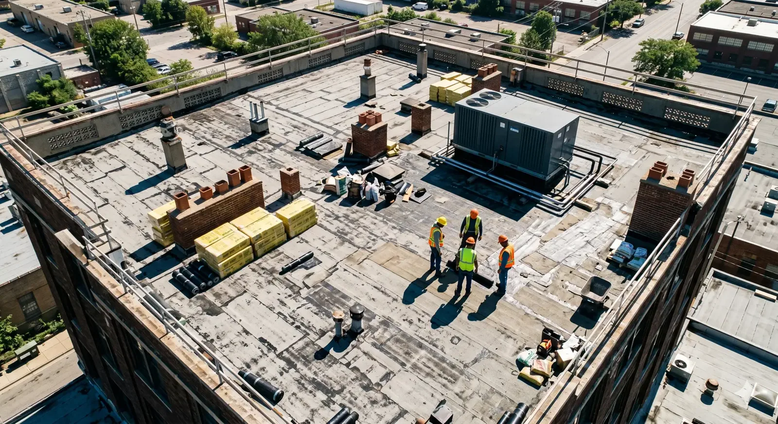
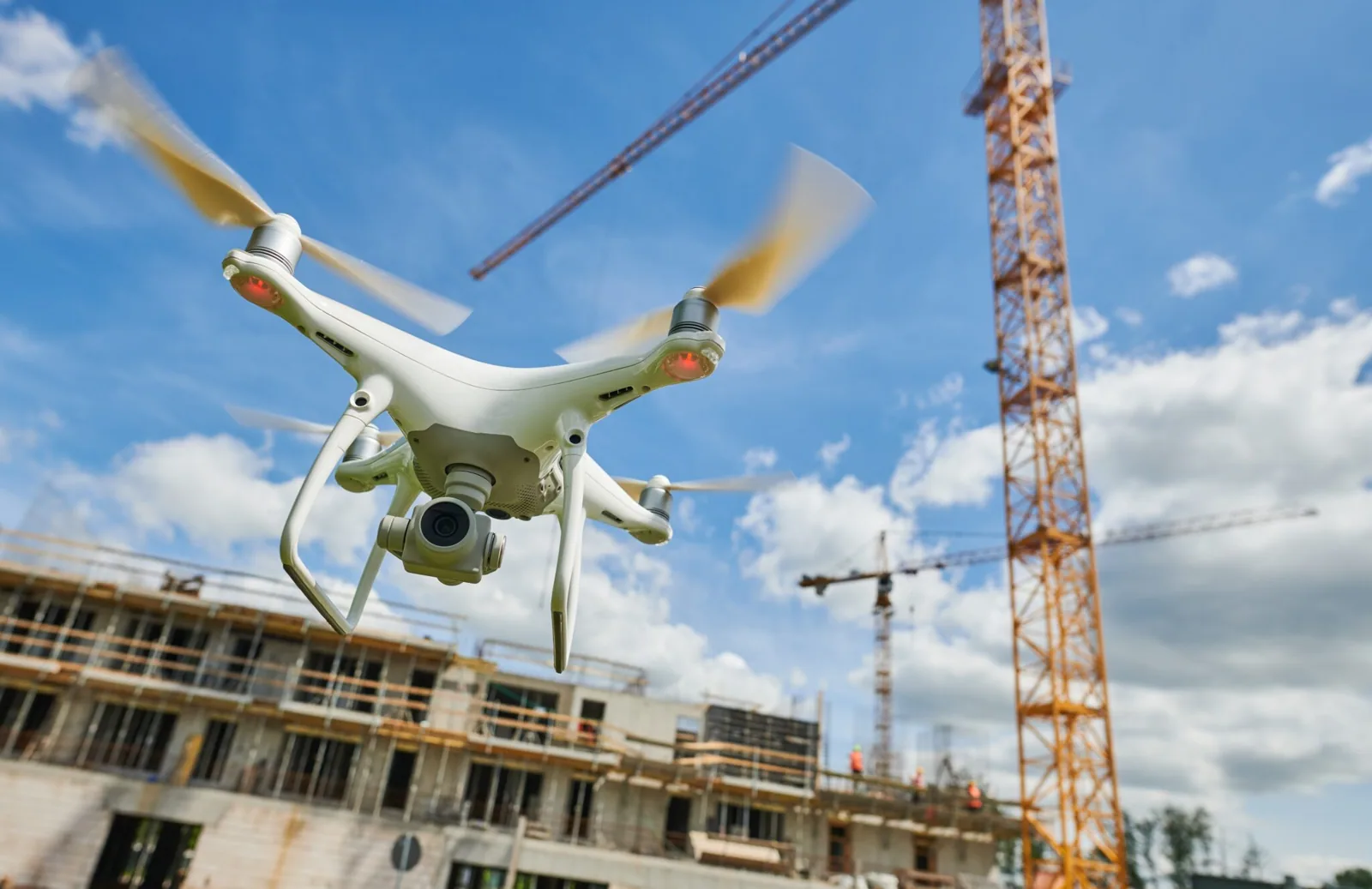
Rows of rooftop units can make a large Renton roof difficult to survey from one safe walkway. Drone imaging gives the property team a broad view of accessible surfaces, equipment layout and areas that may need a closer look. It is useful for coverage and visual context, but it does not test a seam, confirm wet insulation or replace a hands-on roof walk. Sea-Tac's monthly climate normals show a wet-season and midsummer contrast, but the camera records only visible roof conditions during the flight, not moisture inside the building being photographed.
The Renton Valley Subarea includes warehousing and industrial properties where roof access may cross active receiving and equipment routes. An aerial image can help orient a future visit, compare visible conditions across sections and mark obstacles that affect access. We plan the flight around weather, safe takeoff and landing, site rules and nearby operations. Afterward, we review the images with the manager, identify what they show and note where a roof-level inspection or moisture test is still needed. The deliverable should help choose a next action, not imply that a camera saw through the roof.
Flight window: plan for safe coverage
Before launch, we confirm property permission, access points, the roof sections to capture and any site restrictions. Wind, rain, visibility and nearby activity can affect whether a flight is appropriate. We identify a safe launch and recovery area with the property contact and keep clear of people, vehicles and active loading routes. If conditions change, the flight may need to wait or cover only the areas that remain safe and practical to reach.
Over Downtown Renton, where the city maps a Downtown Business District overlay, the person who controls each site sets the flight permission, launch point and hours, so that conversation comes first. A hands-on inspection can follow the image review and check the details a camera cannot touch. If visible surface patterns suggest a particular seam or drain, we mark it on the image set for a ground-level confirmation. The plan records which sections were captured and any blocked view so an owner knows what the image set covers.
Image set: read the surface in context
Images can show ponding areas, debris, equipment clusters, visible membrane damage, open access routes and changes between roof sections. Perspective and glare can hide small defects, while surface discoloration can have more than one cause. We sort images by roof area, keep useful context around each close view and label observations for follow-up. A photo can point a roofer toward a detail, but the image alone does not determine whether the membrane is loose or the insulation below it is wet.
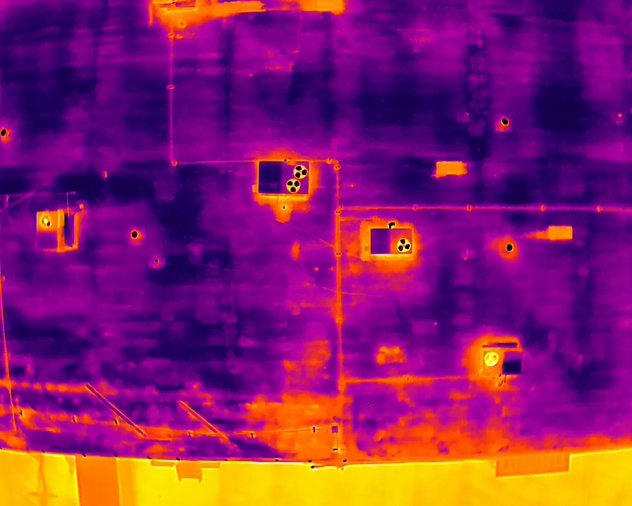
From the air, a downtown office roof and a Valley warehouse roof can look alike, so we match each image to the property plan and to the site contact's account of how each section is used. The infrared survey may help locate temperature patterns for additional checking; a core cut, when authorized, can confirm layers at a selected point. If the image shows a suspicious curb or drain, a drain review or equipment-curb inspection can test the detail in person.
Roof walk: test the detail on the surface
After the image review, a field check can examine seams, flashings, drains and penetrations highlighted in the photos. We compare the close-up with the actual material, look for movement or moisture and note whether the detail accepts a repair. The field inspection can change the initial interpretation: a visible dark area may be staining, a surface treatment or standing water rather than a membrane break. The report keeps image observations separate from conditions confirmed on the roof.
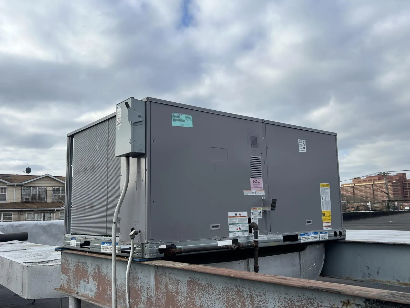
Logistics and light manufacturing in the Renton Valley Subarea bring varied rooftop equipment and service routes, so we confirm clearances and operating restrictions at the property before anyone walks the roof. If images identify a possible leak route, leak tracing can test that path. Where visible damage appears after strong wind or rain, a storm-damage review can document the affected area without assuming the event caused every surface mark.
Report: connect each image to a decision
A useful drone deliverable includes dated images, a simple roof-area reference, observations and limits. The property team should be able to locate the image on the building and understand whether it shows a confirmed defect, a visual concern or an area requiring closer access. We flag obscured roof sections, equipment shadows and weather limits rather than describing them as inspected. If the image set supports a repair quote, we identify which areas need a hands-on measurement before final scope.
For larger properties, images can help managers compare visible areas during a later inspection, provided the same roof sections and angles can be reached. The condition report can organize image references with field findings and repair priorities. For a portfolio in the Renton Valley Subarea, an image index can make it easier to coordinate roof access, but each building still needs its own evaluation. We keep the record tied to the site contact's roof plan rather than relying on an aerial view with no location context.
Next check: choose the right tool
Drone imaging is most useful when a broad visual survey can reduce time spent locating areas or help plan safe access. It is less useful when the decision depends on a bond, seam weld, concealed moisture or a small flashing failure that needs direct contact. We explain whether the next step is a roof walk, infrared survey, core sample, leak test or repair quote. The owner can then match the tool to the question rather than ordering an image package that cannot answer it.
Weather, flight restrictions, property permission and safe launch space influence timing. If a flight cannot capture a roof section clearly, we note that limit and recommend another inspection method. The manager receives images and a short list of what they can support, what they cannot establish and where the team should look next. That keeps the visual review useful for maintenance and capital decisions while leaving diagnosis to the appropriate field check.
Commercial Roofing Questions
What can a drone show on a commercial roof?
It can provide visual coverage of accessible surfaces, roof sections, equipment layout, debris, ponding and visible damage. Image angle, glare and shadows can limit detail. We label observations that need a hands-on check so the property team does not treat a visual cue as a confirmed leak or hidden moisture condition.
Can drone images confirm wet insulation?
No. An image camera records visible surfaces; it does not test the layers below them. Infrared imaging can flag temperature patterns for investigation, and an approved core cut can inspect insulation and deck at a selected location. We use the method that fits the question and explain its limits.
Do we need to close the building during a flight?
A full closure is not always needed, but the property contact must approve the plan and identify safe launch, recovery and operating areas. People, vehicles, loading activity, wind and site rules all affect where the aircraft can work. If a safe path is not available, we reschedule or use another inspection method.
How do you use the images after the flight?
We organize them by roof area, mark visual concerns and identify which locations need field confirmation. A hands-on visit can then inspect the seams, drains, curbs or flashings in question. The report keeps the images connected to the roof plan and notes any section the flight could not capture clearly.
Can the same flight replace a yearly roof inspection?
Drone coverage can support planning, but it does not replace hands-on checks of accessible details or testing of concealed layers. A roof walk can find loose seams, weak flashing and drain problems that a surface image may not resolve. We recommend drone coverage when it helps, then set the field work needed for the building.